SkyFi Expands ATAK Plugin to Deliver Real-Time Satellite Imagery to Tactical Edge
-
| Defense Systems Analyst

SkyFi has announced a significant expansion of its plugin for the Android Team Awareness Kit (ATAK), enabling direct access to real-time satellite imagery within tactical environments. This development aims to enhance situational awareness for military units and first responders by integrating commercial Earth observation data directly into mission planning and execution workflows.
ATAK as a Tactical ISR Backbone
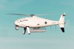
The Android Team Awareness Kit (ATAK) is a widely adopted geospatial situational awareness tool developed by the U.S. Department of Defense (DoD) and used across NATO forces, federal agencies, and emergency response teams. It provides a common operational picture (COP), enabling secure communication and coordination among dismounted users via mobile devices. ATAK supports plugins that allow integration of various sensor feeds, targeting tools, UAV control interfaces, and now—via SkyFi—satellite imagery layers.
Originally developed by the Air Force Research Laboratory (AFRL), ATAK has become a key enabler of C4ISR capabilities at the tactical edge. Its plugin architecture allows third-party developers like SkyFi to extend functionality without altering core codebases—a critical feature for rapid capability insertion in dynamic operational environments.
SkyFi’s Plugin Expansion: Capabilities and Use Cases
SkyFi’s enhanced plugin allows users to request commercial satellite imagery on-demand from within the ATAK interface. The company partners with over 70 commercial Earth observation providers—including Maxar Technologies, Umbra Space (synthetic aperture radar), Satellogic, and Planet Labs—to offer high-resolution electro-optical (EO) and SAR imagery. The plugin supports:
- Selection of area-of-interest (AOI) directly on the map interface
- Tasking of satellites with near-real-time revisit rates
- Integration of returned imagery into mission overlays
- Support for both EO and SAR data types
- Offline caching for denied or degraded comms environments
This capability is particularly valuable in austere or denied environments where traditional ISR assets like UAVs or manned reconnaissance aircraft may be unavailable or vulnerable. For example:
- Tactical reconnaissance in contested areas without air dominance
- BDA (Battle Damage Assessment) after long-range fires or airstrikes
- Disaster response mapping post-earthquake or flood events
- Border surveillance missions with limited aerial coverage
Simplifying Satellite Tasking for Non-Experts
A key innovation lies in SkyFi’s user interface design philosophy—making satellite tasking accessible to non-specialists. Traditional satellite tasking often requires knowledge of orbital mechanics, sensor characteristics (e.g., GSD/resolution vs swath width trade-offs), cloud cover forecasting, and licensing constraints. SkyFi abstracts these complexities through an intuitive UI that allows users to select AOIs on a map and choose between “Archive” or “New Task” options based on urgency.
The backend handles provider selection based on availability windows, resolution requirements (as fine as ~30 cm GSD from some vendors), weather forecasts (for EO sensors), pricing tiers, and delivery timelines—often within hours depending on constellation density.
SAR Integration Expands All-Weather ISR Options
An important aspect of this expansion is support for synthetic aperture radar (SAR) data via partners like Umbra Space. SAR provides imaging capabilities through cloud cover and at night—critical limitations for electro-optical sensors in many operational theaters such as tropical regions or Arctic latitudes.
SAR’s ability to detect changes over time through coherent change detection (CCD) or interferometric techniques adds value in monitoring infrastructure damage, detecting vehicle movement patterns under camouflage netting, or identifying illicit construction activity across borders.
Security Architecture and Deployment Considerations
The SkyFi plugin is designed with secure deployment models compatible with military-grade networks. While initial implementations are focused on unclassified commercial imagery workflows over LTE/Starlink-type comms links, future iterations may include:
- Integration with classified enclaves via cross-domain solutions
- Caching mechanisms using edge compute nodes at TOCs/FOBs
- Support for encrypted transmission using NSA-approved Type-1 crypto modules when required
- User authentication tied into existing ATAK credential management systems such as PKI/CAC tokens or MDM platforms like Nett Warrior/End User Device programs
Tactical Implications: Democratizing Space-Based ISR?
The broader implication of this capability lies in democratizing access to space-based intelligence collection—not just at strategic echelons but down to platoon/company-level operators. By embedding satellite tasking into a familiar mobile interface used by JTACs, SOF teams, border patrol agents or humanitarian responders alike—SkyFi bridges the gap between orbital assets and ground truth needs.
This aligns with broader trends observed across NATO militaries emphasizing distributed operations supported by resilient ISR architectures that do not rely solely on exquisite national assets vulnerable to anti-access/area-denial threats.
Outlook: Commercial Constellations as Tactical Enablers
The proliferation of LEO-based EO/SAR constellations—with revisit cycles measured in minutes rather than days—is transforming what’s possible at the tactical edge. Companies like BlackSky Global offer sub-hourly monitoring; Capella Space provides persistent all-weather SAR; while Planet Labs’ daily global coverage supports pattern-of-life analysis at scale.
If integrated effectively into tools like ATAK—with bandwidth-aware delivery pipelines—the result could be near-continuous overhead awareness even without UAV loiter time or manned recon sorties. This could reshape how commanders plan raids, monitor ceasefires violations under OSCE mandates—or coordinate disaster relief logistics after hurricanes.