China’s Arctic MilTech Push: Historic Sub-Ice Dive Signals Dual-Use Capabilities
-
| Defense Industry & Geopolitics Observer

China has completed its largest-ever Arctic scientific expedition, culminating in a historic first manned dive beneath the polar ice cap. While framed as a research initiative, the mission underscores Beijing’s growing interest in dual-use maritime technologies in the High North—raising questions about future military applications in this strategically vital region.
Historic Dive Under Polar Ice Raises Strategic Eyebrows
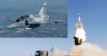
On April 24, 2024, China’s deep-sea manned submersible “Deep Sea Warrior” (深海勇士号) successfully completed a dive beneath the Arctic ice cap—a first for any Chinese crewed submersible. The dive took place during China’s 13th Arctic scientific expedition aboard the research vessel Xue Long 2 (Snow Dragon 2), which departed Shanghai in July 2023 and concluded after over eight months at sea.
The operation marked a milestone not only for Chinese polar science but also for its deep-sea operational capabilities. According to China’s Ministry of Natural Resources (MNR), the submersible reached depths exceeding 1,000 meters under multi-year pack ice—conditions that require advanced navigation systems, robust hull design to withstand extreme pressure and low temperatures, and precise under-ice positioning capabilities.
This achievement places China among a small group of nations—including Russia and the United States—that have demonstrated crewed under-ice submersible operations. Such capability has clear strategic implications beyond scientific research.
Xue Long 2 and China’s Expanding Polar Logistics Chain
The Xue Long 2 is China’s first domestically built polar research icebreaker. Commissioned in late 2019 by the Polar Research Institute of China (PRIC), it features twin-directional navigation (bow and stern), an endurance of up to two months without resupply, and an operating range exceeding 20,000 nautical miles. It complements China’s older Ukrainian-built Xue Long I vessel but offers significantly enhanced scientific payloads and dynamic positioning systems.
During this expedition—which covered over 40,000 nautical miles—the ship conducted oceanographic surveys across multiple sectors of the central Arctic Ocean. It deployed autonomous underwater vehicles (AUVs), remotely operated vehicles (ROVs), seabed mapping tools using synthetic aperture sonar (SAS), and environmental monitoring buoys equipped with satellite uplinks.
While these platforms are nominally civilian-scientific assets, their underlying technologies—underwater communications networks, bathymetric mapping systems, long-endurance AUVs—mirror those used in naval ISR (Intelligence-Surveillance-Reconnaissance) missions. The line between civil science and military utility is increasingly blurred in Chinese polar operations.
Dive Platform: Deep Sea Warrior’s Dual-Use Potential
The Deep Sea Warrior is one of China’s flagship manned submersibles developed by the China Ship Scientific Research Center (CSSRC) under the state-owned China State Shipbuilding Corporation (CSSC). Operational since late 2017, it can reach depths of up to 4,500 meters and has been deployed extensively in South China Sea resource surveys as well as deep-sea trench exploration missions.
- Crew capacity: Three personnel
- Endurance: Up to ten hours submerged
- Sensors: Multibeam sonar arrays; HD optical imaging; manipulator arms for sampling
- Navigation: Inertial navigation system integrated with Doppler velocity logs; acoustic transponder network support
- Hull material: Titanium alloy pressure sphere rated for high-latitude cold-water operations
The platform’s ability to operate autonomously or semi-autonomously under polar ice suggests potential applications for seabed surveillance or cable inspection missions—both critical components of modern naval strategy. Notably, similar Western platforms such as the U.S. Navy’s NR-1 or Russia’s Losharik have been linked to submarine cable reconnaissance roles.
Strategic Context: Why the Arctic Matters to Beijing
The Arctic holds growing geopolitical significance due to climate change-driven sea route accessibility and untapped hydrocarbon reserves. While not an Arctic Council member state or geographically adjacent power like Russia or Canada, China declared itself a “Near-Arctic State” in its January 2018 White Paper on Arctic Policy—a term met with skepticism by regional stakeholders.
This recent expedition reinforces Beijing’s ambition to be recognized as a legitimate stakeholder in shaping future governance norms for the region. It also aligns with China’s Belt & Road Initiative extension into what it calls the “Polar Silk Road”—a concept linking Eurasian trade corridors through emerging Northern Sea Routes (NSR).
The ability to map subsea terrain under ice caps could offer navigational advantages for future commercial shipping—and potentially military submarines—operating through these corridors. Moreover, data collected on thermohaline circulation patterns may feed into broader climate modeling but also inform anti-submarine warfare models sensitive to salinity gradients affecting sonar propagation.
Diversifying Undersea Capabilities Amid Global Tensions
This milestone comes amid increasing global competition over seabed infrastructure security—from submarine cables to rare earth deposits—and reflects broader trends toward militarization of dual-use oceanographic tools.
- NATO concerns: Alliance reports have warned about Russian activity near critical underwater infrastructure; similar attention is now turning toward Chinese capabilities.
- U.S.-China competition: Washington has increased funding for unmanned maritime systems via DARPA programs like Manta Ray; Beijing appears intent on matching such capabilities through state-led R&D efforts like those seen aboard Xue Long missions.
The integration of AI-enabled AUV swarms or persistent seabed sensors—technologies reportedly tested during earlier Chinese expeditions—could provide persistent maritime domain awareness below traditional radar horizons. This would complicate adversary submarine operations while enhancing China’s own deterrence posture in contested waters from the South China Sea to potentially even parts of NATO’s northern flank if access routes open via NSR corridors.
Conclusion: Science Meets Strategy Beneath Polar Ice
The successful manned dive beneath Arctic pack ice marks not just a technological feat but also signals Beijing’s maturing capability set across deep-sea domains traditionally dominated by Western navies. While presented under a scientific banner—and undoubtedly contributing valuable climate data—the dual-use nature of platforms like Deep Sea Warrior raises valid concerns among defense planners watching China’s expanding footprint from pole to pole.
If current trends continue—with increasing integration between civil maritime research institutions and defense-linked state enterprises—the next phase may see more overt deployment of ISR-capable platforms under thinly veiled “research” missions across global chokepoints including Svalbard approaches or Greenland-Iceland-UK gaps. The High North may be entering an era where bathymetry becomes battlespace prep—and every buoy might be more than just weather data collection gear.